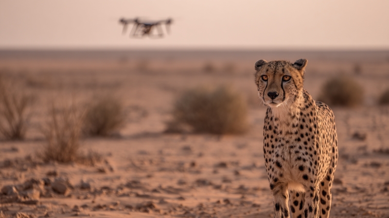
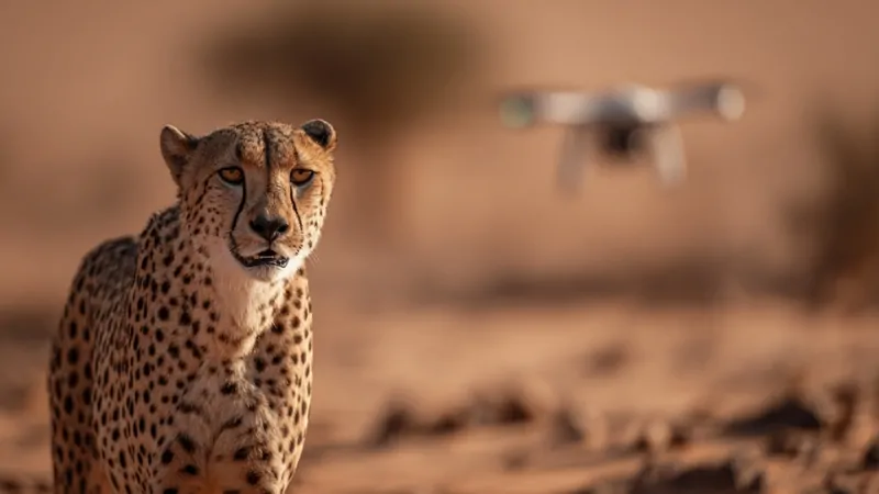
Drones are protecting the Sahara’s endangered cheetahs by enabling scientists and conservation teams to locate, monitor, and protect one of the rarest big cat populations on Earth across vast desert terrain that is nearly impossible to patrol on foot or by vehicle.
In the central Sahara, where fewer than a few hundred Saharan cheetahs are believed to remain, drones provide real-time surveillance, non-invasive tracking, and early warning against poaching and human encroachment, all while reducing costs and risks for field teams.
The Saharan Cheetah and Why Protection Is Uniquely Difficult
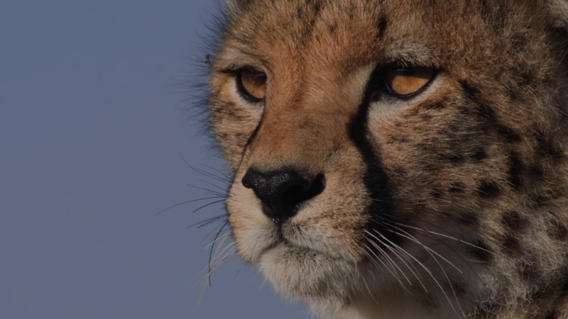
The Saharan cheetah, often classified as Acinonyx jubatus hecki, is the most endangered cheetah subspecies. Current population estimates range from roughly 200 to 250 individuals spread across Algeria, Niger, Chad, Mali, and parts of Libya.
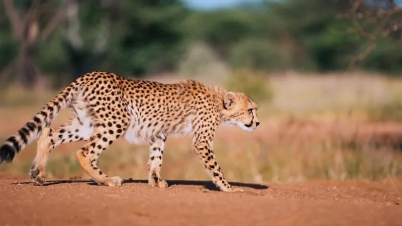
These animals occupy territories that can exceed 1500 square kilometers per individual, a scale far larger than that of savannah cheetahs. Their activity patterns are also unusual: to cope with extreme heat, Saharan cheetahs are mostly nocturnal, moving and hunting at night when visibility is poor, and ground patrols are least effective.
Traditional wildlife monitoring tools struggle in this environment. Camera traps are frequently buried by sand or destroyed by temperature extremes that can exceed 50 degrees Celsius.
GPS collars are expensive, require physical capture, and can fail due to heat and battery degradation.
Aerial surveys using planes or helicopters are prohibitively costly and logistically complex in remote desert regions. This combination of vast range, low population density, and harsh conditions is precisely where drone-based monitoring becomes viable.
Why Drones Changed the Equation in The Sahara
The Sahara covers more than nine million square kilometers. Conservation teams working with organizations such as the Sahara Conservation Fund and national environmental agencies operate with limited budgets, small staff, and minimal infrastructure.
Drones reduce the scale problem. A single fixed-wing drone can survey hundreds of square kilometers in a single flight, while multirotor drones can hover and conduct focused inspections around watering sites, prey corridors, and suspected human activity zones.
Unlike manned aircraft, drones can fly low and slow, capturing high-resolution imagery without disturbing wildlife. Thermal sensors allow detection of warm-bodied animals at night, matching the cheetah’s nocturnal behavior.
Importantly, drone missions can be planned repeatedly over the same corridors, producing consistent datasets rather than one-off snapshots.
Types of Drones Used in Saharan Cheetah Protection
Different conservation tasks require different drone platforms. Most field programs combine at least two drone types to balance coverage and detail.
Drone type
Typical flight time
Coverage area
Primary use
Fixed-wing drones
60 to 120 minutes
100 to 500 km² per flight
Large-scale population surveys, corridor mapping
Multirotor drones
20 to 45 minutes
2 to 10 km² per flight
Targeted monitoring, watering points, and human activity
Hybrid VTOL drones
60 to 90 minutes
50 to 200 km² per flight
Mixed terrain surveys without runways
Fixed-wing drones are particularly valuable in the Sahara because they handle wind better and offer long endurance.
Multirotor drones remain essential for precise work, such as confirming tracks, inspecting carcasses, or monitoring areas near settlements.
Thermal Imaging and Nocturnal Tracking
View this post on Instagram
One of the most significant advantages drones bring to Saharan cheetah protection is thermal imaging. During nighttime flights, infrared cameras can detect temperature differences between animals and the surrounding sand, even when the cheetah is partially concealed.
Field studies in southern Algeria between 2018 and 2023 demonstrated that thermal drone surveys detected cheetah presence at rates two to three times higher than ground-based night patrols.
Thermal data also helps distinguish cheetahs from livestock, foxes, and humans based on movement patterns and body size. This reduces false positives and allows teams to focus limited resources on verified cheetah zones rather than speculative searches.
Anti-Poaching Surveillance and Early Warning
Poaching is not the only threat to Saharan cheetahs, but it remains a serious one. Illegal hunting, retaliatory killing due to livestock conflict, and unregulated wildlife trade all pose risks.
Drones are increasingly used as an early warning system rather than as direct enforcement tools.
By mapping vehicle tracks, temporary camps, and new access roads, drone teams can identify human intrusion before animals are harmed. In Niger’s Termit and Tin Toumma region, drone patrols between 2020 and 2024 contributed to faster ranger response times and a measurable reduction in illegal hunting signs in monitored sectors.
Threat Indicators Detected by Drone Surveillance
Indicator
Detection method
Conservation response
Fresh vehicle tracks
High-resolution daytime imagery
Ranger deployment, checkpoint setup
Night campfires
Thermal sensors
Rapid response patrol
Livestock movement
Visual tracking over time
Conflict mitigation outreach
Illegal traps
Low altitude inspection
Removal and documentation
The value here is not confrontation but prevention. When local authorities and communities are informed early, escalation is less likely.
Population Estimation and Movement Data
Because Saharan cheetahs are so sparsely distributed, even small errors in population estimates can skew conservation planning. Drone imagery allows repeated counts over defined areas, reducing reliance on indirect signs such as tracks alone.
When combined with spoor analysis and occasional genetic sampling, drones help refine minimum population estimates and identify core habitat zones.
Movement data derived from drone observations has revealed that Saharan cheetahs frequently reuse specific corridors between rocky massifs and sandy plains, particularly routes that intersect gazelle populations.
Protecting these corridors has become a priority, influencing where patrols, community engagement, and legal protections are concentrated.
Costs and Logistical Realities
Drone programs are often described as cost-effective, but the reality is nuanced. Initial investment includes hardware, spare parts, training, and regulatory compliance.
However, when compared to aircraft charters or large-scale ground patrols, drones are substantially cheaper over time.
Approximate Annual Monitoring Costs per 1000 Km²
Method
Estimated annual cost
Personnel risk
Data frequency
Ground patrols only
High
High
Low to medium
Manned aerial surveys
Very high
Medium
Very low
Drone-based monitoring
Moderate
Low
High
Another logistical advantage is adaptability. Drones can be deployed quickly in response to emerging threats such as sudden livestock influxes or reports of poaching, without weeks of planning.
Limitations and Ethical Considerations
Drones are not a complete solution. Sandstorms, extreme heat, and wind regularly ground flights. Battery performance degrades rapidly in desert conditions, requiring careful mission planning.
There are also ethical concerns regarding surveillance over areas used by local communities. Conservation programs increasingly include clear protocols on data use, transparency with residents, and strict limits on imagery storage.
Importantly, drones do not replace rangers, scientists, or community engagement. They extend the reach of these efforts, but cannot substitute for long-term human presence and trust-building.
What Drone Data Has Already Changed
Over the past decade, drone use has shifted Saharan cheetah conservation from reactive to evidence-driven. Protected area boundaries have been adjusted based on real movement data.
Patrol routes now align with actual risk zones rather than assumptions. In some regions, confirmed cheetah presence detected by drones has influenced national conservation priorities and funding allocation.
From a field perspective, the most practical change is certainty. Teams can now say with greater confidence where cheetahs are, where they move, and where threats are emerging, rather than relying on sporadic sightings separated by months or years.
Bottom Line
@ccfcheetah Today is Endangered Species Day! So, are cheetahs endangered? There are fewer than 7,000 cheetahs remaining in the wild. Currently, the cats are listed as vulnerable by the International Union for Conservation of Nature (IUCN). However, two subspecies – the Asiatic cheetah and the Northwest African cheetah – are currently listed as critically endangered. In 2023, research published by Cheetah Conservation Fund (CCF) helped lead to the Northeast African cheetah, the subspecies found in the Horn of Africa, being reclassified as endangered. Today, fewer than 500 Northeast African cheetahs remaining in the wild. In Somaliland, CCF is combating the illicit trade in wildlife by addressing both the ecological and human dimensions of conservation. The Cheetah Rescue and Conservation Centre (CRCC) is a sanctuary and rehabilitation center for cheetahs rescued from the illegal wildlife trade. The Centre is home to more than 100 rescued cheetahs. Now, the Somaliland Camera Trap Project, launched earlier this year, is combining community insights and technology to fight the illegal wildlife trade. Part of a larger effort to better understand cheetah populations in the region, the study will also provide critical baseline data for conservation interventions. In 2024, construction also began on a new Education Centre at the Cheetah Rescue and Conservation Centre (CRCC) in Somaliland. Dedicated to protecting the Northeast African cheetah, the Education Centre will serve as a hub for training supporting conservation and sustainable livelihoods. Want to learn more? Visit cheetah.org ##endangeredspecies #endangered #wildlife #animals #conservation #cheetah #ecology #biodiversity #ccfcheetah ♬ Glimpse (Slowed + Reverb) – Gabriel Albuquerqüe
Drone technology continues to evolve toward longer endurance, better thermal resolution, and automated image analysis. Machine learning models trained on desert wildlife imagery are beginning to assist in species identification, further reducing manual workload.
For Saharan cheetahs, this means more consistent monitoring without increasing disturbance or cost.
Drones are not saving the Saharan cheetah on their own. They are, however, closing a critical information gap in one of the most challenging conservation landscapes on Earth.
In a region where visibility, access, and time are constant constraints, that gap matters.